I came across a New York Times article on the impacts of zoning on single family housing and the lack of multi-family housing in our cities. I was curious about the make up of the two cities I've spent most of my life in: Lubbock, Texas and Fort Worth, Texas.
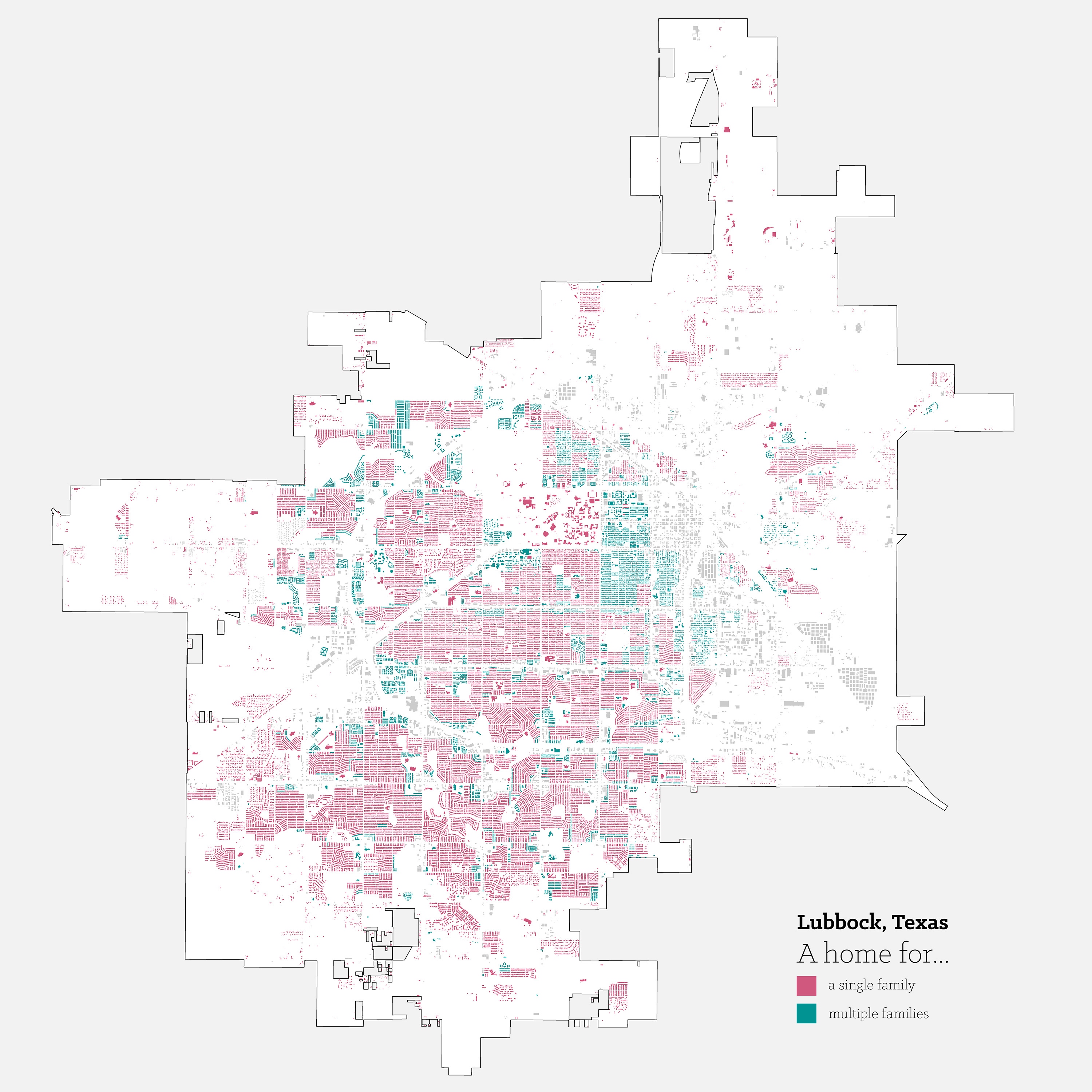
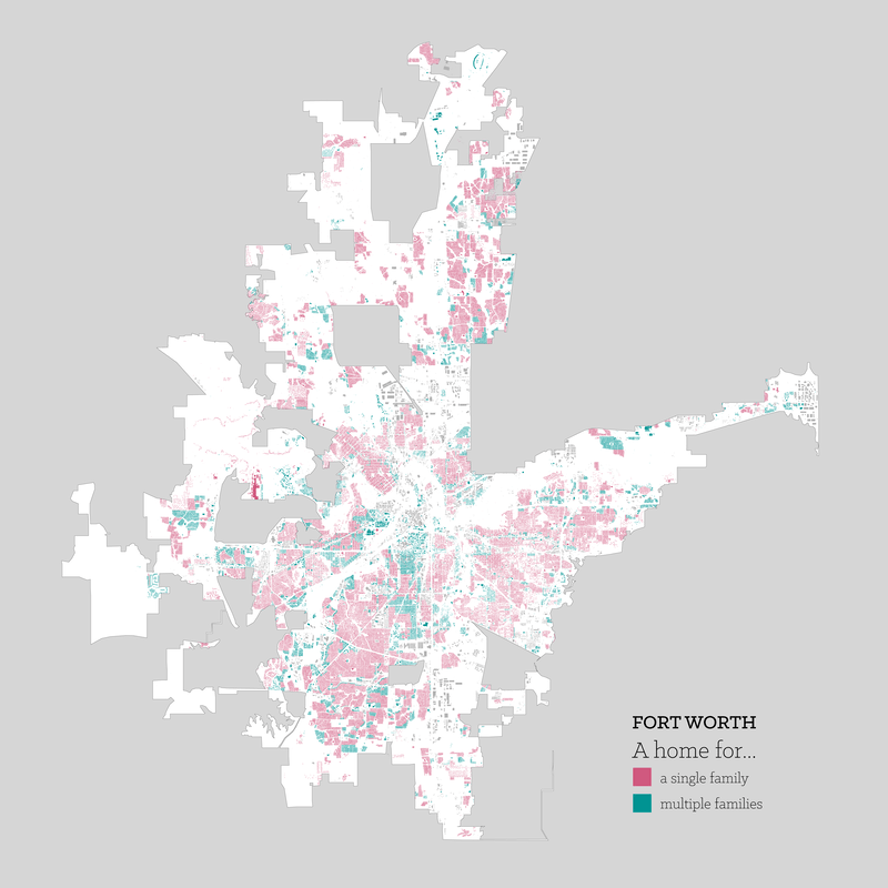
Using R along with city provided zoning and building information, I was able to generate the following maps highlighting the areas of single family and multi-family zoning. It is astounding how much land we have used for single houses. Our cities, especially here in Texas, tend to grow out instead of growing up as everyone chases the dream of a yard for every house.

Taking a look at Lubbock, Texas, the city grid is immediately apparent in the resulting map. The city had no topography to respond to as it grew, resulting in it's regimented layout.
There are clusters of multi-family housing, but a majority of it is adjacent to the university. That said, there are smaller clusters of multi-family areas along major through-fares on the southern half of the city. As the city grew and continues to grow south, the amount of single family housing is astounding.

Suburban sprawl is on full display in this map of Fort Worth, Texas.
It is worth nothing that there are full neighborhoods here that are zoned for some type of multi-family development. In the case of the Fairmount and Near Southside neighborhoods, the neighborhoods are zoned for a maximum use of townhomes, however what the lots are zoned for and what is currently built on the lots aren't always the same. In that particular case, it is still currently single family homes, and with the historic designation of the neighborhood, that might not change anytime soon.
