Inspired by the work of Erin Davis, I set out to explore the relationships between street routes and naming nomenclature in the cities that are important to me. R is really the key to this, as it has allowed me to work with datasets much larger than I've ever been able to with Grasshopper + Rhino.
I've been asked to sell prints of these so now you can find them at: society6.com/tylrprtr
If your city isn't available, just reach out! I can generate them for any US city.

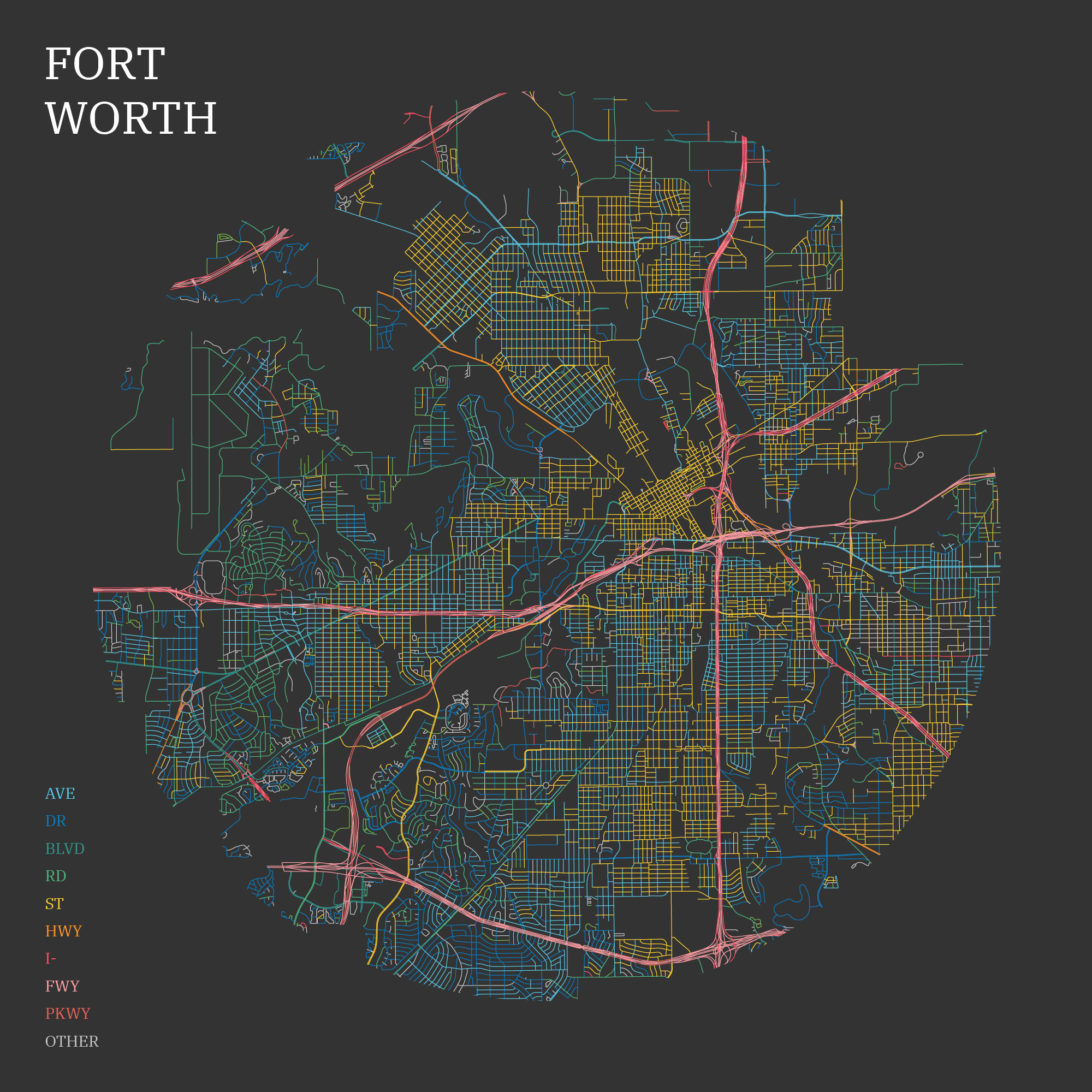
I started by looking at Fort Worth, Texas, my current hometown.
Even though I have lived here for over 4 years, I did not realize that downtown is comprised entirely of streets. I even work there! Beyond Downtown, the next oldest areas of the city have alternating avenues and streets.

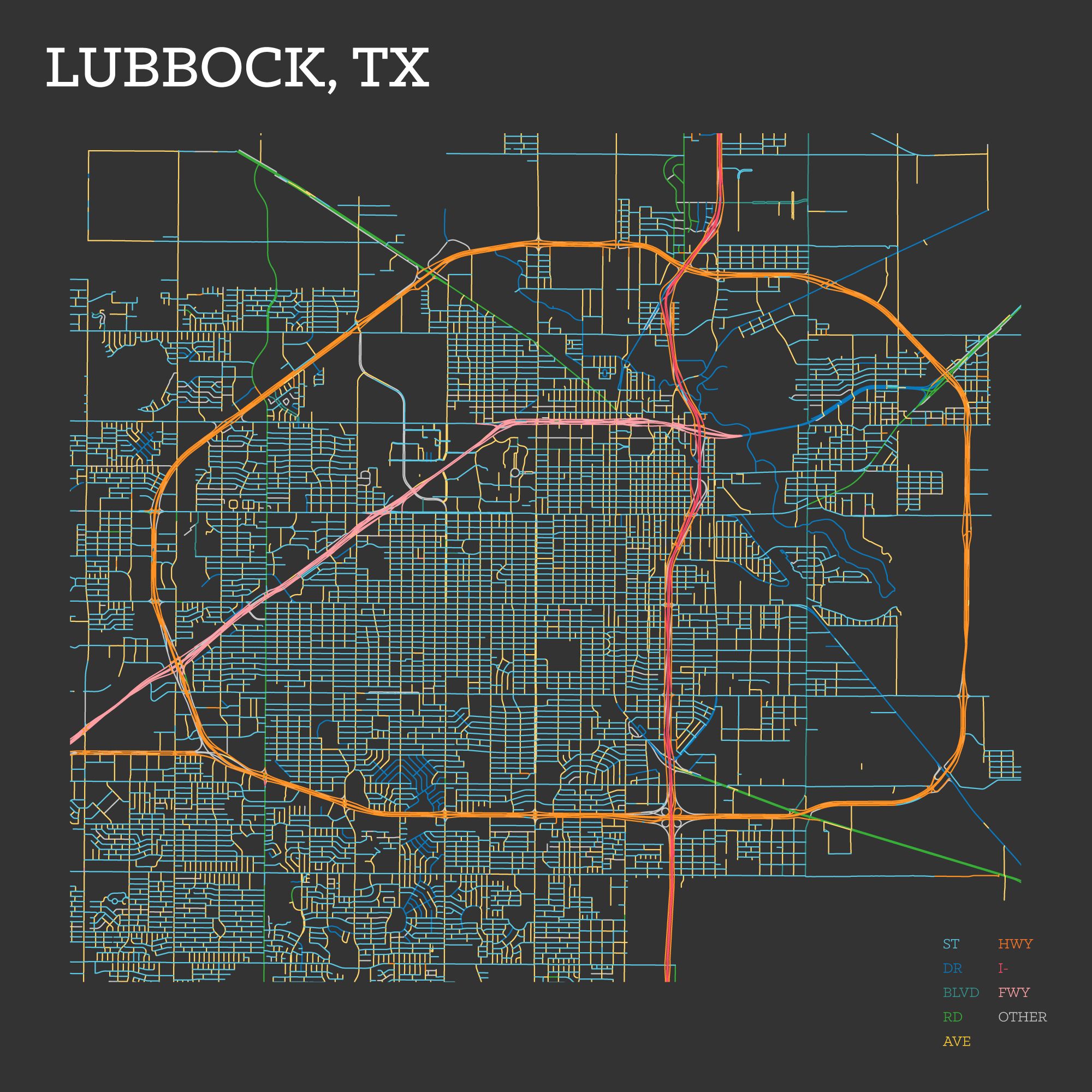
A city very dear to me: Lubbock. It's where I spent my college years.
Devoid of any topography to deal with, the city is laid out on a square mile grid. Avenues run north south and streets run east west.

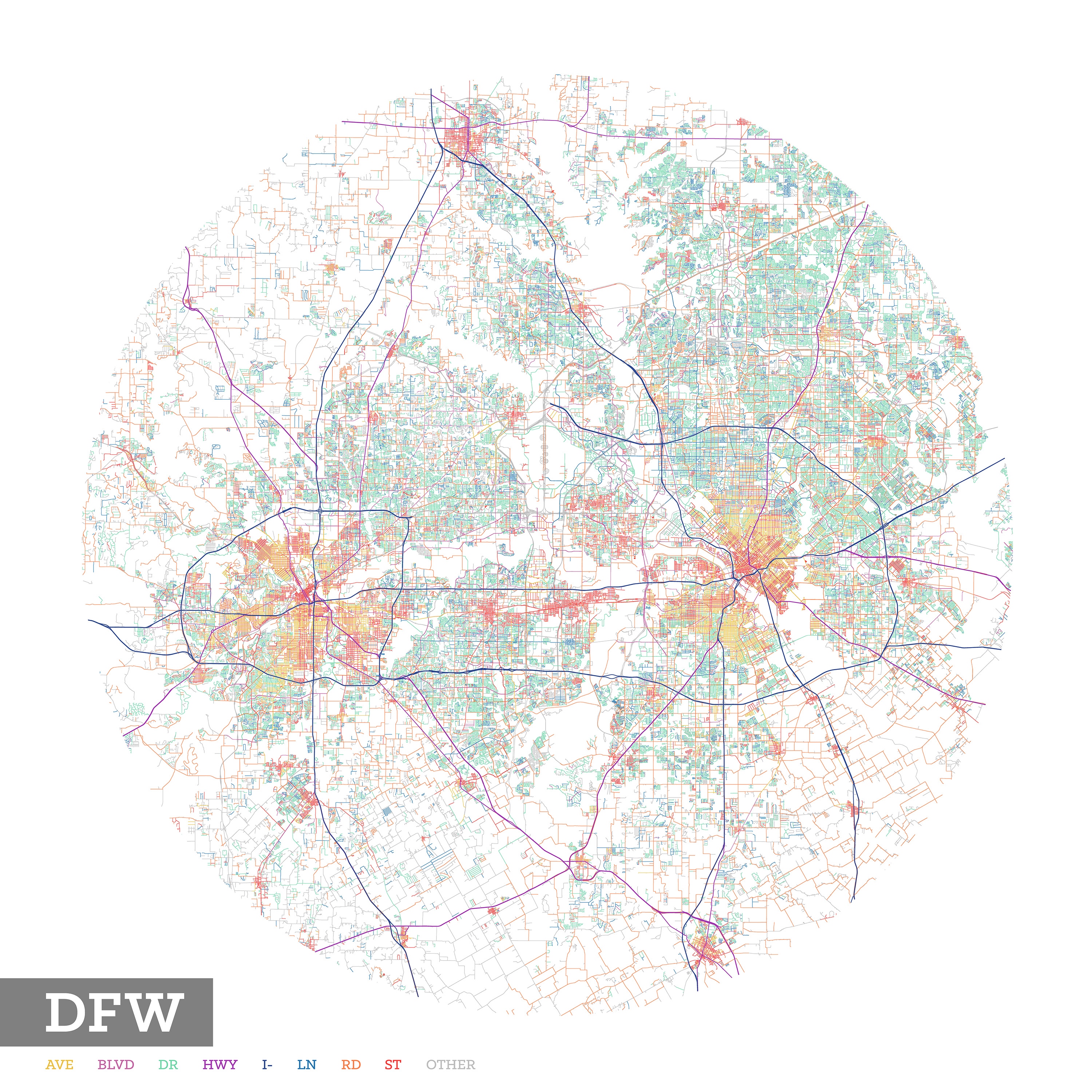
Taking a look at the entire metroplex highlights that while the city centers show a mix of avenues and streets, the sprawling suburbs have a lot of drives, like a LOT of drives.
I guess it's not marketable for a house to be on a street or avenue?

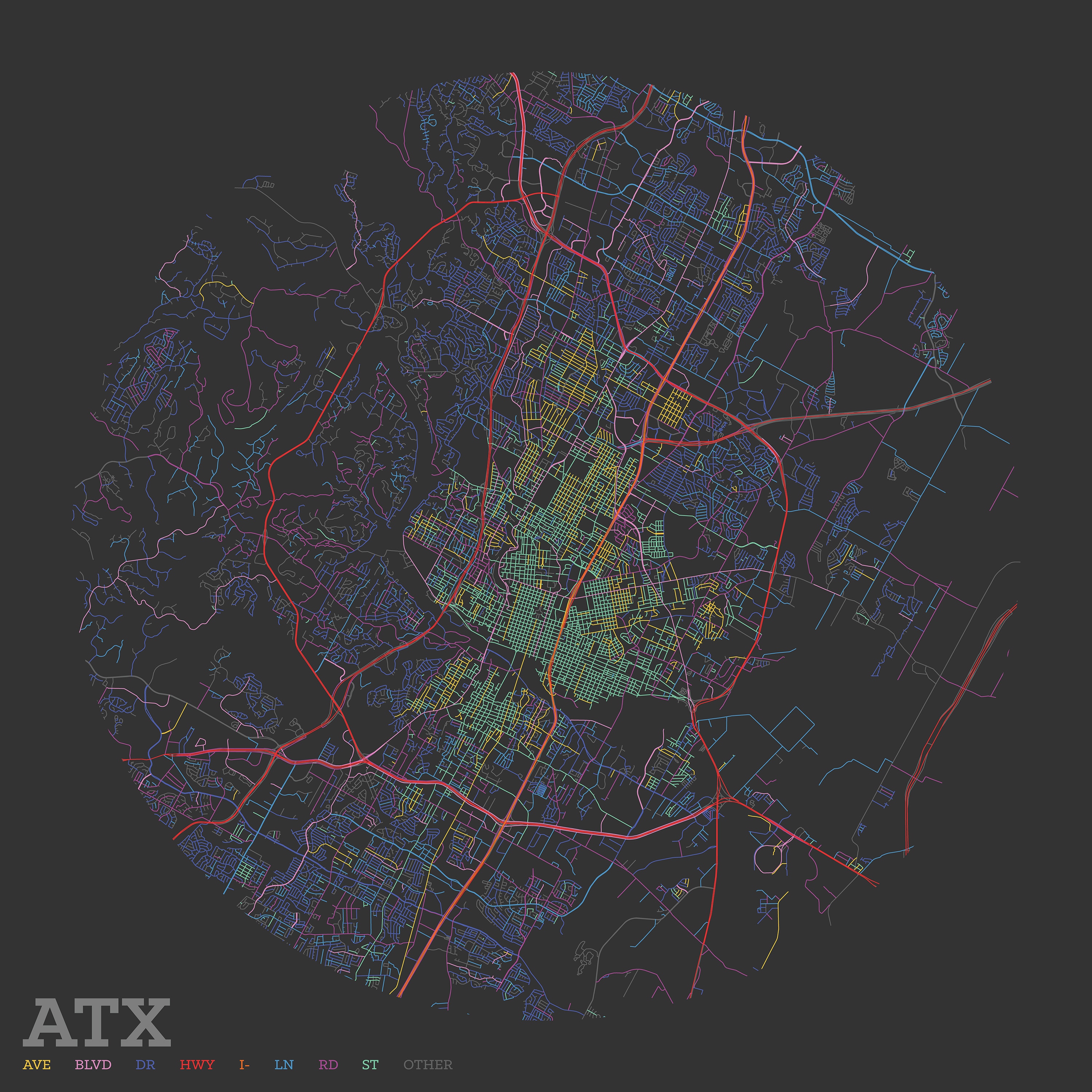
Austin was a request from a friend. I don't have any experience with the city, but it I do like the big organizational shift from the downtown area compared to the western part of the city. The geography of Barton Hills and Rollingwood neighborhoods have some topography to deal with, and the layout reflects that.
It also appears that the same naming rules apply here that were apparent in DFW: heavily residential areas have more non-avenue and non-street names.
